
West Sumbawa Lombok & Sumbawa guide
A clear comparison framework for Kertasari, Moro Bay and Poto Tano, focused on access, topography, services and project fit.
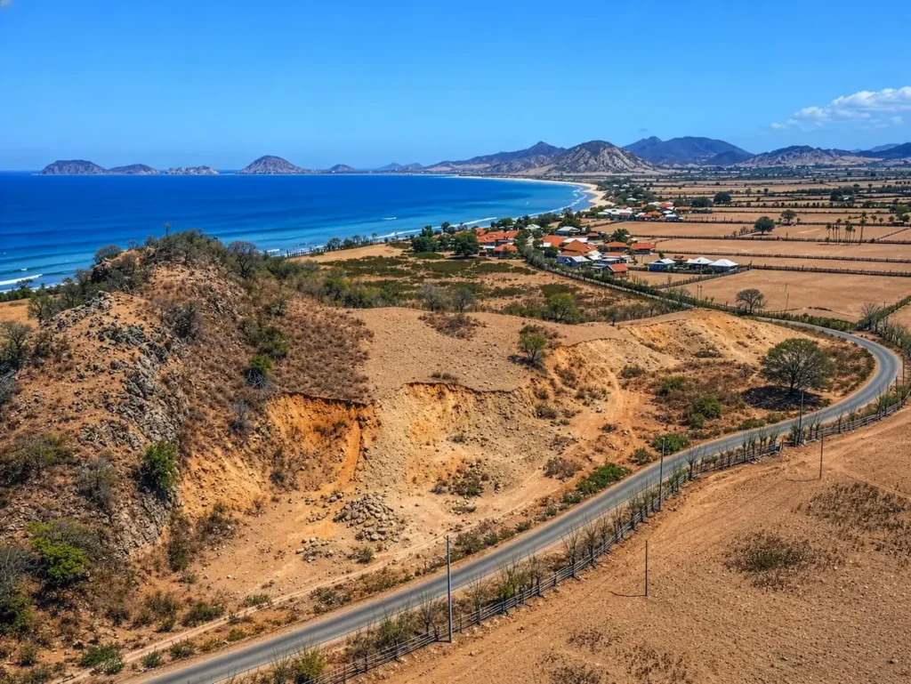
West Sumbawa offers a different land-buying experience from a dense urban market. Buyers may be comparing coastal plots, elevated land, large agricultural parcels and development opportunities around Kertasari, Moro Bay, Tua Nanga, Poto Tano and nearby areas.
The quiet setting can be a major attraction, but it also makes practical verification more important. Before choosing a view, understand access, utilities, document quality, local services and how the land fits your intended project.
Kertasari: coastal access and project scale
Kertasari listings can appeal to buyers seeking beachfront or coastal land. Review the exact distance to the beach, legal access, coastal conditions, drainage, shoreline setbacks and the availability of power and water. A beach view does not automatically mean direct beach access or permission to build close to the shore.
For a hospitality project, estimate how guests, staff, suppliers and emergency vehicles will reach the site. A larger parcel may need an internal road, water storage, waste management and a phased construction plan.
Moro Bay: views, topography and surf locations
Moro Bay and the surrounding Kertasari area include plots with different elevations and access patterns. Elevated land can provide a strong outlook, but check the slope, soil, drainage, retaining-wall requirements and construction access. Flat land may reduce earthworks but still require careful rainwater management.
When a listing mentions a nearby surf break, resort or travel time, record the information as an approximate starting point. Visit the route and verify the distance yourself. You can review a Moro Bay example and compare its specifications with other listings.
Poto Tano: transport and connectivity questions
Poto Tano is an important transport reference for West Sumbawa. Ask how the property connects to the ferry route, the nearest town, supplies, healthcare and construction services. Check whether the road is public, privately maintained or dependent on a neighbour’s land.
Do not price a property solely on a proposed future infrastructure project. Treat future airports, roads or tourism facilities as unconfirmed until an independent source and the relevant authority support the information.
Documents and boundaries
Request the land documents, seller identification, tax information and any survey. The notary should review ownership, encumbrances, inheritance, consent and the transaction structure. A surveyor should locate the boundary on the ground and compare it with the advertised area.
Services and construction cost
Ask the local utility providers how power and water can reach the parcel. Calculate the cost of poles, transformers, wells, tanks, pumps, septic systems, drainage, internet and access improvements. Remote land can be excellent for privacy while requiring a larger infrastructure budget.
A simple comparison method
Create a table with location, land size, title information, access, topography, utilities, price per are, travel time and due-diligence status. Add a column for unanswered questions. This prevents the most attractive photo from hiding the largest project risk.
Browse the full Lombok and Sumbawa land catalogue or contact the team for listing information. Before paying, appoint independent legal and technical advisers in Indonesia.
Ready to compare a property?
Use this guide alongside the listing details, then arrange an independent site visit and professional review before making a commitment.
Editorial note: This guide is general education, not legal, tax, planning or investment advice. Requirements and property facts should be verified with independent professionals.
